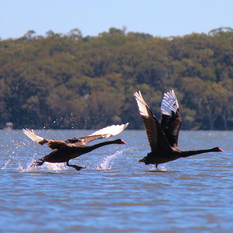
The Maroochy River floodplain within the dynamic Maroochy River catchment contains the diverse ecosystems of the majestic Maroochy River, creeks, estuaries, wetlands and saltmarsh. It provides habitat for a range of animals including migratory birds and threatened species.

This ecologically significant coastal lowland contains significant vegetation communities which are Groundwater Dependent Ecosystems. These include the largest stand of Coastal Swamp Oak (Casuarina glauca) in Australia which has recently been listed as nationally endangered - Coastal Swamp Oak Forest of South-East Queensland and New South Wales; Subtropical and Temperate Coastal Saltmarsh community which is EPBC listed as critically endangered; and a threatened population of endangered water mouse (Xeromys myoides). This extremely flood-prone parcel is also in close proximity to the Yandina Creek Wetlands and the Coolum Creek Conservation Reserve and sits within the 'Blue Heart.'

A 510 ha mixed-use urban development with a 'wave pool' (pitched as 'Surf Ranch Sunshine Coast') has been proposed by Consolidated Properties Group. The proposed location for this intensive urban development sits within the Maroochy River floodplain and is subject to permanent flooding/standing water, tidal inundation and acid sulphate soils.

This massive development poses significant risks and impacts on the Maroochy River, the floodplain and wider catchment.

The proposal

Development company Consolidated Properties is seeking to build an intensive residential and mixed use development with a 'wave pool' on a 510ha parcel within the Maroochy River floodplain at Coolum West. This land, is zoned ‘Rural’ and outside the Urban Footprint in the relevant South East Queensland Regional Plan (SEQRP/Shaping SEQ) and outside the Urban Growth Management Boundary in the Sunshine Coast Planning Scheme. A portion of the site was designated State Key Resource Area (KRA 156) in 2013.

It is being marketed as Surf Ranch Sunshine Coast.

In terms of development, the draft development concept plan suggests around 12 hectares for the wave pool, 83 hectares of residential development, with another 17 hectares for hotel and apartments associated with the wave pool, retail, light industry, and school; and another 20 hectares for community sports.

The developer has made it very clear that both the residential development (1500 lots) and mixed-use activities, including the ‘wave pool’ are inextricably linked. This strongly suggests the project is not viable nor sustainable.

Background

BACKGROUND & HISTORY

In approx. 2004 Consolidated Properties lodged an Application for Preliminary approval for a residential master-planned community, namely Coolum Lakes, on a 387 hectare flood plain at Coolum West, then owned by Jay Chandler. Council and the State Government did not support the development and it rightly did not proceed. Despite this, Consolidated Property Group continued speculatively to buy up parcels in the floodplain to now have a 510 ha holding (‘the site’).

Questionable representations made by the developer to have his holding included in the Urban Footprint in ShapingSEQ were appropriately not supported. In mid-2017, Consolidated Properties subsequently announced its intention to progress an application to operate a sand mine under the Key Resource Area designation over a large portion of the site. This did not proceed.

Consolidated Properties' objective is still to turn the site into an extensive residential/commercial development with the ‘wave pool’ component simply the marketed ‘Trojan horse’ for urban development.

Key Planning Issues

  • Existing Rural Zoning under the Sunshine Coast Planning Scheme 2014 (a consistent zoning carried through from earlier local planning instruments)
  • Regional Landscape and Rural Protection Area designation under the SEQ Regional Plan.
  • Multiple State Planning Policy matters:
  1. Acid Sulfate Soils (ASS) over the entire site.
  2. Important Agricultural Area and Agricultural Land Class A and B
  3. Key Resource Area for sand (KRA156), plus separation area and transport route, covering a significant portion of the site.
  4. Erosion Prone Area.
  5. High Storm Tide Inundation Area.
  6. Some areas of High Ecological Significance Wetlands and Regulated Vegetation (Essential Habitat).


State Interests associated with this development

State Planning Policy 4 provides:

“Development in bushfire, flood, landslide, storm tide inundation or erosion prone natural hazard areas:

  • avoids the natural hazard area; or
  • where it is not possible to avoid the natural hazard area, development mitigates the risks to people and property to an acceptable or tolerable level.”

and includes the advice that:

“Planning schemes should acknowledge the risks identified through the flood risk assessment process. They should present a clear strategic settlement pattern that supports the achievement of broader flood risk management objectives for the LGA. … This may involve avoiding new urban development in flood-prone areas of intolerable risk, or excising higher risk areas from the urban footprint.”

Council and the State have in fact properly integrated the State Interests by zoning this land rural and excluding it from the Urban Footprint and outside the Urban Growth Management Boundary. Any flood risk assessment could only conclude that the risk for this site is “intolerable” as defined in the Policy. The public interest is not met by exposing the community to an “intolerable” flood risk.

Flooding

The site sits entirely within the Maroochy River floodplain and experiences flooding to significant depths and tidal inundation. It is understood the storage capacity of the Maroochy River lower estuary floodplain has already been exceeded by the ’priority fill’ of current lots in the Twin Waters, Marcoola, Pacific Paradise and Mudjimba localities.

The role and vulnerability of the Maroochy River catchment and floodplain have been recognized by the Queensland State Government when it endorsed the inclusion of fluvial processes in the development of the Coastal Hazard Adaptation Strategy (CHAS) for SCRC. Flood related planning issues: 

  1. Flood Hazard Area under the planning scheme (the entire site is subject to Current Climate Riverine Flooding)
  2. The most limiting factor is compliance with the Flood Hazard Overlay Code.

The Overall Outcomes of the Flood Hazard Overlay Code are:

  • development does not occur on land subject to flooding except in specified circumstances and only where the impacts of flooding can be effectively ameliorated such that there is no foreseeable risk to life or property;
  • development protects floodplains and the flood conveyance capacity of waterways development in areas at risk from flood and storm tide inundation is compatible with the nature of the defined flood or storm tide event;
  • the safety of people is protected and the risk of harm to property and the natural environment from flood and storm tide inundation is minimised; and
  • development does not result in a material increase in the extent or severity of flood or storm tide inundation.

It will be difficult to achieve the Performance Outcome (PO1) for Floodplain Protection under the Flood Hazard Overlay Code:

Development is undertaken in a manner that ensures:-

  • natural hydrological systems are protected;
  • natural landforms and drainage lines are maintained to protect the hydraulic performance of waterways; and
  • development integrates with the natural landform of the floodplain rather than modifying the landform to suit the development.

At Odds with the Blue Heart

The site is in the area designated by the Sunshine Coast Regional Council in partnership with the State Government and Unity Water, as the “Blue Heart” – Blue Carbon initiative. This is a worthy initiative that should be progressed to its maximum extent (5,000 ha) for the multiple benefits it would provide. These benefits include;                                 

  • The Blue Heart will strengthen the Maroochy-Noosa Wallum Corridor;
  • The area has high biodiversity values as recognised at a state and national level;
  • Regional climate resilience;
  • Catchment-wide flood mitigation, storage and conveyance;
  • Ecological restoration and enhancement;
  • Economic and environmental benefits derived from carbon sequestration and ecosystem services;
  • Nature-based (low impact) ecotourism and cultural tourism opportunities;
  • Significant and enduring regional community and social benefits such as parklands, sports fields and open space; and
  • Scenic and visual amenity.

A project such as that currently proposed by Consolidated Properties would irrevocably undermine and negatively impact on the considerable merits and long-term, sustainable public interest benefits of the Blue Heart.

Ecological Impacts

Apart from potential impacts on the important and sensitive hydrology of the site, the developer has indicated that water for the wave pool will be extracted from the Maroochy River. There are many questions and issues around such a proposal:

  • How will such extraction impact on the ecology of the river, both macro and micro biodiversity? At what rate would water be extracted?
  • If there is an intent to replenish the water in the wave pool, with what frequency and what impacts on the river ecology and balance?
  • What would be the implications for mineral mobilisation with acid sulphate and humic soils?
  • The Maroochy River is a declared Fish Habitat area – what impacts might a potential change in the salt/freshwater and pH balance have?

The Maroochy floodplain has significant vegetation communities which are Groundwater Dependent Ecosystems. These include the Coastal Swamp Oak (Casuarina glauca) Forest of South-East Queensland and New South Wales ecological community which is listed as nationally endangered - ; Subtropical and Temperate Coastal Saltmarsh community which is EPBC listed as vulnerable; and a population of vulnerable water mouse (Xeromys myoides). 

The recreational fishing values of the river are currently in decline, and this will only add to the impact on the highly lucrative tourism industry and valued past-time of locals. A full ecological study over time of the impact of any of the proposed changes to the floodplain should be undertaken before any consideration of development or any similar activity on any part of the Maroochy floodplain.

The 'Wave Pool'

When community groups met with Mr Don O’Rorke (Consolidated Properties) and Mr Andrew Stark (World Surf League), they were questioned regarding the accessibility of the facility to the general surfing community. Their response indicated that this was not a facility for the casual surfer or a surfing family to “have a surf” on the way home from work or on the weekend.

They were also asked about cost and would not give any information in relation to its affordability again for the casual surfer or surfing family. We have heard of costs in the range of $100’s of dollars for one wave attempt and thousands of dollars for daily hire.

Surfrider Sunshine Coast says "Our love of surfing does not override our need to protect. We are not against development but it must be appropriate. The building of housing/accommodation, retail area & a wave pool on a floodplain marked by the Sunshine Coast Council’s Blue Heart project as an area ‘to protect and enhance this area for blue carbon sequestration, habitat for biodiversity and water processing’ raises many questions. We support the Sunshine Coast Environment Council, Coolum and North Shore Coast Care, Friends of Yaroomba, OSCAR and Development Watch Inc in their quest for answers."

Is this a tourism attraction? No, the 'wave pool' is a 'trojan horse' for urban development. 

SCEC and fellow community groups OSCARDevelopment Watch , Coolum Residents Association ,Friends of Yaroomba and Surfrider Sunshine Coast have no objection to a ‘wave pool’ per se in the region. However, this is not the right location. We remind the community, the developer and the State that the site proposed for this development is currently zoned rural and is outside both the SCPS Urban Growth Management Boundary and the South East Queensland Regional Plan Urban Footprint Boundary.

Public Information

The Surfranch Sunshine Coast website is a blatant marketing tool.

In relation to some of the key issues, particularly in the Frequently Asked Questions (FAQ’s) the information is either non-existent, obtuse or misleading. This particularly relates to questions related to flooding, residential development, urban footprint and environmental issues.

For example:

  • When asked to justify the claim of 10,000 jobs over the life of the project, the developer indicated there is a formula where the project spend multiplied by a factor gives the number of jobs. This model has been found to be totally flawed in relation to other projects and grossly overestimates employment and is misleading.  
  • The FAQ relating to flooding and Acid Sulphate Soils almost dismisses them by making a statement re mitigation of flood impacts but with no detail.
  • One FAQ asks whether the proposal is outside the urban footprint - in the answer, there is no reference at all to being outside the Urban Footprint under the SEQ Regional Plan 2017 (Shaping SEQ).
  • In terms of commercial drivers they say ”the surf facility must be underpinned by broader commercial drivers such as an eco-lodge, training facilities, residential and tourist accommodation.” Such a statement does not give the full extent and impacts of the other elements of the proposal.
  • At no point do they say that the proposed shopping centre and residential subdivision are prohibited development under the relevant provisions of the Planning Regulation 2017.

Pushing for constrained land north of the Maroochy River for developer ambitions is not their 'call'. There are legislated processes that involve genuine community consultation and transparent consideration of site constraints, not a slick marketing campaign and lobbying the state for objectionable declarations.  The development ambitions of this developer (or any other developer for that matter) is not the means by which planning for an ecological sustainable South East Queensland should be undertaken. The whole Planning Process under the Planning Act 2016 and the principles underpinning that Act define how planning is undertaken.

Key Resource Area

The site is located within the Maroochy North Coolum Key Resource Area 156.

While it would be concern if this KRA became operational, it is a designated state resource for sand - not a supply for a private developer to use as 'fill' for urban development!

Because of their economic importance to the state, significant extractive resources must be protected from development that could impact on their long-term availability.

The Key Resource Area (KRA) concept is a planning tool designed to protect resources from being rendered inaccessible by urban expansion.

Extractive Resource description:
A significant deposit of construction sand occurs in the alluvial flats of the Maroochy River. This deposit consists of marine fine-grained silica sand overlying estuarine and marine muds and clay in places covering possible fossil alluvial channels or tidal fine to coarse-grained silica sand.

Special considerations:
A large part of the resource is subject to the provisions of the Queensland Coastal Plan administered by the Department of Environment and Heritage Protection. Drilling also confirmed the presence of acid sulphate soils in some samples.
Most of the KRA is covered by Strategic Cropping Land Trigger Mapping under the Strategic Cropping Land Act 2011 administered by the Department of Natural Resources and Mines. This indicates the location of potential SCL and further on-ground assessment against the SCL criteria is required to confirm whether the area is SCL or non-SCL

It's Clear

No proposal for any further urban development on the Maroochy Floodplain should contemplated. It is particularly important, given the flood data available and the challenges of climate change that we do not further compromise the flood storage capacity of the Maroochy Floodplain.

The floodplains must be protected and preserved!

HELP MAKE THIS MESSAGE LOUD & CLEAR BY SIGNING THIS PETITION

Stay tuned for further updates as we continue to work closely with local groups and the community to protect the Maroochy Floodplain.