Navigating the Path to a Greener Future
SCEC actively keeps up to date with environmental actions, events, and significant updates across our own campaigns and those of our support groups. You'll find a collection of articles that spotlight the latest strides in safeguarding our planet. From inspiring stories of conservation efforts to in-depth coverage of impactful events, we're committed to keeping you informed about the pressing matters shaping our environment.
Stay engaged, stay informed, and join us in our journey toward a greener and more sustainable future.
Signing up today ensures you stay informed about all SCEC News & Events!

Community Coalition Responds to Planning Minister’s Approval of Coochin Creek Mega Music Festival and Exhibition Centre

Open Letter to the Deputy-Premier & Planning Minister
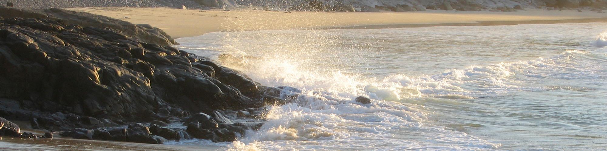
Coochin Creek Mega Festival Proposal Raises Major Concerns for the future of Pumicestone Passage and our green belt
%20July%202025.JPG&wid=900)
Community Coalition Urges Refusal of Coochin Creek Mega Music Festival and Exhibition Centre
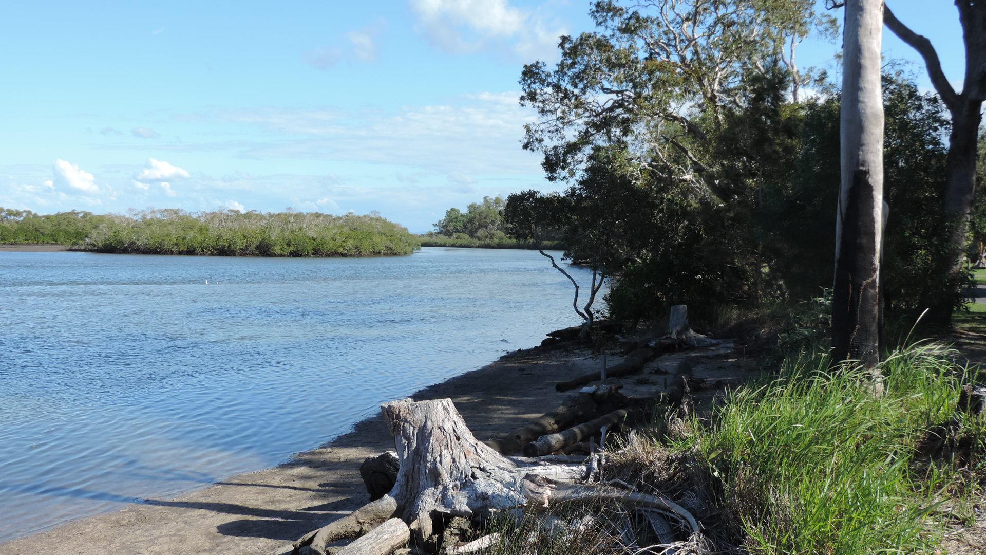
Community raises concerns over approval of Comiskey Group tourist park on Pumicestone Passage

Help Preserve the Inter-Urban Break and Protect Pumicestone Passage
📣 Make your voice heard on the proposed Outdoor Exhibition & Festival development at Coochin Creek by 08 December

MEDIA RELEASE: Community Concerns Escalating Over Coochin Creek Developments
More than two dozen Coochin Creek residents gathered on Roys Road recently to meet with representatives from the region’s leading community and environmental organisations to raise serious concerns about the escalating impacts of two major development proposals at Coochin Creek — a super-sized Big4-style Tourist Park and a 35,000-person mega Music Festival & Exhibition Event Site.

🌿 Speak Up for Coochin Creek and the Inter-Urban Break🌿
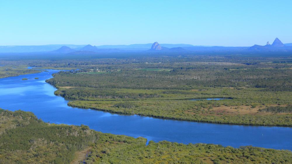
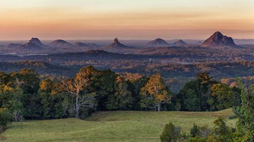
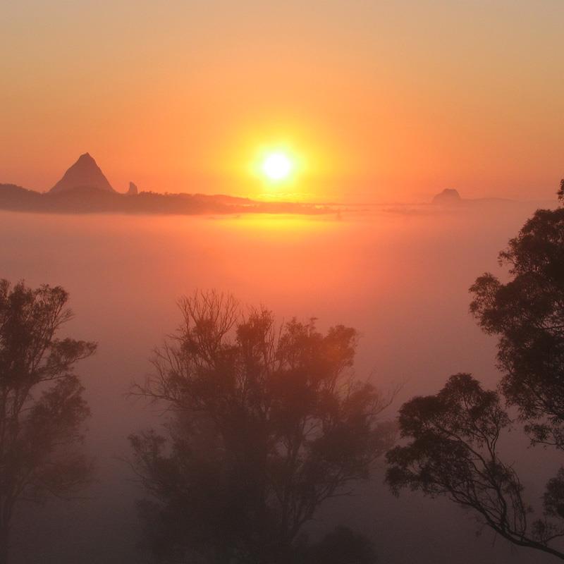
Protect the Northern Inter-Urban Break — once it’s gone, it’s gone forever. The Northern Inter-Urban Break — the vital green belt separating the Sunshine Coast and Moreton Bay regions — is under serious threat from inappropriate development. Your voice is urgently needed by 17 November to help protect this irreplaceable landscape and safeguard the Pumicestone Passage, one of South East Queensland’s most significant natural assets.

Community Coalition Urges Public to Have Their Say on Coochin Creek Tourist Park
A coalition of ten community organisations is urging residents to make submissions during the short community consultation period for the controversial Coochin Creek Tourist Park development application which closes on 17 November.


State Agency recommends Minister refuse both controversial Coochin Creek developments

State Government Agency Recommends Refusal of Coochin Tourist Park Plans
A coalition of Sunshine Coast community groups says Planning Minister Jarrod Bleijie MP would have to ignore expert advice from his own specialised planning agency if he decides to approve a contentious application by the Comiskey Group for a large-scale ‘Big4’ style tourist park on the sensitive Pumicestone Passage.
Community Concerns Mount as Planning Minister Overrides Local Processes
Community groups across the Sunshine Coast are further alarmed with the Confirmation Notice issued on 21 July 2025 by Deputy Premier and Planning Minister Jarrod Bleijie which progresses objectionable intervention into local planning processes
.png&wid=1587)
SCEC's WEDFest Plastic Free Celebration!
The Sunshine Coast Environment Council is holding its highly acclaimed World Environment Day Festival on Saturday, 16 August at Marina Bar Noosa along the Tewantin riverfront from 12:00 to 3:00pm. This year, SCEC’s dedicated program aligns with the United Nations Environment Programme’s campaign of ‘Ending Plastic Pollution’ calling for meaningful action to address the pressing issue of plastic pollution and its harmful effects on the environment, human health, and the climate.


A call from the community to save South East Queensland
As the 2024 State election approaches, we—the residents, wildlife rescuers and carers, catchment, and conservation groups of South East Queensland—are united in our concern for the future of our region. This includes protecting the green belt of the northern inter-urban break between the Glass House Mountains and the Pumicestone Passage.

New environment watchdog election commitment for Queensland welcomed 11 October
The Queensland Conservation Council and Regional Conservation Councils have welcomed Labor’s commitment to introduce an independent environmental protection agency (EPA), calling for a bipartisan approach to ensure accountability for environmental protection.
.jpg&wid=1000)
The Sunshine Coast has lost a great environmental advocate and leader with the recent passing of Hermann Schwabe whose legacy lives on

Community-Driven Renewable Energy in Caloundra
Discover how Caloundra's community-driven renewable energy initiatives, supported by a $40 million commitment from the Queensland Government, are pioneering emission reduction efforts and promoting equitable access to clean energy.

To drive impactful change and keep our advocacy and voice strong, we need your support. Here’s how you can support SCEC as the Regional Conservation Council and peak environmental advocacy organisation since 1980...

Conservationists and Scientists Unite for Smart Regional Planning
Conservationists and scientists have launched a plan to create 'no-go' development zones in Queensland, aiming to protect threatened species and promote smart regional planning.
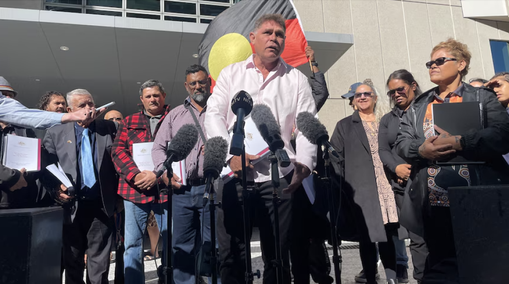
Kabi Kabi People have Native Title recognised
The Federal Court has recognised the Native Title rights of the Kabi Kabi People.
.png&wid=250)

Premiere screening of the ‘Sunshine Coast Climate Emergency Declaration Film’
Attendees at the Sunshine Coast Environment Council's May Green Drinks event watched the premiere screening of this locally made film documenting the power of community action.


QCC hosts 'Why nuclear is not a climate solution for Australia' webinar
In May, Queensland Conservation Council hosted a webinar focusing on why nuclear is not a climate solution for Australia, with Australian Conservation Foundation's anti-nuclear campaigner Dave Sweeney delivering the keynote speech.
Sunshine Coast Biosphere - 24/01/2024
Be part of the change! What difference would you like to create today?
Welcome to January's Edition of Eco News - 17/01/2024
SCEC would like to wish you all a very Happy New Year!
Special Festive December Edition of Eco News - 20/12/2023
Give a gift for the environment and to SCEC this festive season. Special Festive December Edition of Eco News.
You may be aware that the Sunshine Coast Environment Council (SCEC) has been fighting for the environment for over 40 years. During this time we have been fortunate to have the support of wonderful people like you; as well as our amazing volunteers, member groups and the broader community.
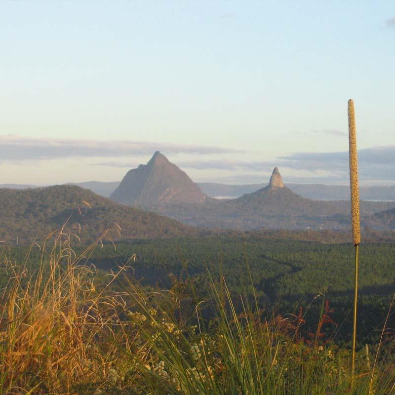
Protect Our Regional Inter-Urban Break
Help protect our region's signature 'Glass House Mountains to Pumicestone Passage Green Belt' by telling the Queensland State Government to give statutory protection of the entire extent of the Regional Inter-Urban Break.
'Aura South' wrong direction for our region-SCEC
The Sunshine Coast Environment Council (SCEC) continues its’ long held opposition to urban development of Halls Creek in the sensitive Pumicestone Passage catchment and within the irreplaceable Regional Inter-Urban Break (RIUB).